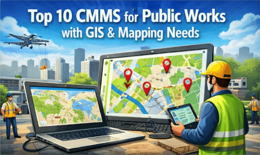
Public works departments manage a vast and complex portfolio of assets spread across entire municipalities. From underground water mains and sewer lines to roads, bridges, and traffic signals, keeping track of maintenance needs is a significant operational challenge. A computerized maintenance management system (CMMS) is the foundational tool for this task, but traditional list-based systems often fall short. Without spatial context, it’s difficult to visualize asset relationships, optimize crew routes, and make informed, location-based decisions. This is where a modern CMMS for public works with integrated mapping becomes essential.
By combining maintenance data with a geographic information system (GIS), departments gain a powerful new perspective on their operations. This integration transforms a simple asset list into an interactive map, allowing managers to see not just what needs attention, but precisely where. Using GIS maintenance software enables more efficient planning, better resource allocation, and smarter long-term capital strategies. This article evaluates the leading CMMS solutions that excel at integrating mapping for public assets, helping you identify the platform that delivers the best operational return on investment.
Why a CMMS with GIS Integration is Critical for Public Works
Integrating GIS capabilities directly into your CMMS provides tangible benefits that impact everything from daily fieldwork to long-term budget planning. This combination moves asset management from a reactive, spreadsheet-based approach to a proactive, visual, and data-driven strategy. The result is a more efficient, resilient, and cost-effective public works operation.
- Enhanced Visualization & Strategic Planning: See all assets, work orders, and maintenance histories on a single map. This visual overview helps optimize crew routes, schedule preventive maintenance more effectively, and inform capital improvement plans with geographic context.
- Improved Field Crew Efficiency: Mobile mapping empowers technicians to locate assets quickly, access work orders spatially, and get turn-by-turn directions. This reduces travel time, minimizes errors, and ensures crews have the information they need on-site.
- Data-Driven Decision Making: Layer CMMS data (like asset condition and repair history) with GIS data (such as zoning, soil types, or flood plains). This allows for smarter repair-versus-replace decisions and helps predict potential infrastructure failures.
- Streamlined Reporting and Compliance: Generate location-based reports for stakeholders, city councils, and regulatory bodies. Visualizing maintenance activities and asset conditions on a map simplifies compliance documentation and makes budget justifications more compelling.
- Increased Data Accuracy: Field crews can use GPS to tag asset locations and update information directly from their mobile devices. This ensures the central database remains accurate and up-to-date, reflecting the true state of your infrastructure.
The ROI of Integrated Systems: By the Numbers
Adopting a CMMS with strong GIS capabilities delivers measurable improvements in efficiency and cost savings. The data highlights how these integrated systems help public works departments optimize resource allocation, extend asset life, and reduce operational overhead.
- Some platforms claim significant efficiency gains, like a 25% reduction in reactive maintenance tasks.
- Vendor credibility can be seen in market penetration; for example, AssetWorks is used by 7 of the 10 largest municipal fleets in the United States.
How We Evaluated These Platforms
Our evaluation is based on a comprehensive analysis of features, user reviews from reputable software marketplaces, and each platform’s specific focus on the public sector. We prioritized solutions that demonstrate a clear understanding of municipal operations and deliver practical, high-value features for public works teams.
- GIS Integration Quality: The depth and seamlessness of integration with GIS platforms, particularly Esri ArcGIS, including two-way data synchronization.
- Public Works Functionality: The presence of specialized modules for streets, water/wastewater, fleet, facilities, and other core municipal assets.
- Mobile Capability: The robustness, offline functionality, and overall usability of the mobile application for field crews.
- Ease of Use: The overall user experience for both administrators and technicians, ensuring quick adoption and minimal training overhead.
- Reporting and Analytics: The ability to generate actionable insights by combining maintenance and spatial data for planning and compliance.
Top 10 CMMS Solutions for Public Works
The following platforms represent the best options for public works departments seeking to leverage GIS and mapping. Each offers a unique blend of features, from deep, GIS-native environments to flexible, user-friendly systems that make mapping accessible to all team members.
eWorkOrders

Flexible CMMS with Powerful Mapping
eWorkOrders is a cloud-based CMMS that provides a comprehensive suite of maintenance management tools with intuitive, powerful GIS mapping capabilities. The platform is designed for scalability and ease of use, making it suitable for diverse public works environments without requiring a steep learning curve. It effectively balances robust work order management, preventive maintenance scheduling, and asset tracking with a visual, map-based interface. This allows teams to manage geographically dispersed assets efficiently, visualize workloads, and optimize field operations. The system is also SOC 2 Type II compliant, ensuring data security for government entities.
Core Strength: A balance of powerful features, user-friendly interface, and exceptional customer support.
Best For: Municipalities seeking a robust, all-in-one CMMS that provides strong mapping capabilities without requiring a dedicated GIS team.
Pro Tip: Use the map-based work order dashboard to visually balance workloads across different service areas.
Cityworks
GIS-Centric Public Asset Management
Built as a native extension of Esri’s ArcGIS, Cityworks is a platform where asset management and work orders are managed directly within the GIS environment. This “GIS-first” approach makes it a top choice for organizations that have already made a significant investment in Esri technology and have GIS professionals on staff. Every asset and every work order exists as a feature on the map, providing unparalleled spatial analysis and visualization capabilities. It is a Platinum Partner in the Esri Partner Network, reflecting its deep integration with the ecosystem.
Core Strength: Unparalleled, seamless integration with the Esri ArcGIS ecosystem for a true GIS-centric workflow.
Best For: Public agencies with a strong existing investment in Esri GIS and a “GIS-first” operational strategy.
Pro Tip: Leverage ArcGIS Insights with Cityworks data for advanced predictive analytics on infrastructure failure.
Cartegraph
Operations Management for Infrastructure
Cartegraph is a high-performance operations management platform that helps local governments manage physical assets, track work, and use data to make smarter infrastructure decisions. Its strength lies in its powerful data analytics and scenario-building tools, which allow managers to forecast budget needs and optimize long-term capital improvement plans. The platform provides robust GIS mapping and mobile capabilities to connect field crews with the central office, ensuring that data collected in the field immediately informs strategic asset management plans. It helps agencies answer critical questions about resource allocation and operational efficiency.
Core Strength: Advanced data analytics and scenario modeling for long-term capital planning and asset lifecycle optimization.
Best For: Data-driven public works departments focused on optimizing resource allocation and operational efficiency.
Pro Tip: Use the scenario builder to justify budget requests with data-backed infrastructure investment plans.
Brightly (Asset Essentials)
Cloud-Based Operations Management
As a Siemens company, Brightly offers Asset Essentials, a widely adopted cloud CMMS with a broad suite of tools for strategic asset management. The platform is designed to manage maintenance, capital planning, and operations across a wide range of public sector entities. Its GIS and mapping features allow users to visualize asset locations, create work orders from the map, and analyze spatial trends. With a strong presence in government, education, and healthcare, Brightly provides a proven, comprehensive solution that can scale to meet the needs of complex organizations with diverse asset portfolios.
Core Strength: A comprehensive feature set and an established presence across the public sector.
Best For: Public entities needing a proven, all-encompassing solution with modules that extend beyond traditional public works.
Pro Tip: Integrate with other Brightly modules for a unified view of assets, energy, and facility usage.
Lucity (CentralSquare)
Public Works Enterprise Asset Management (EAM)
Lucity, now part of CentralSquare, is a purpose-built EAM system providing deep functionality for specific public works disciplines. It offers highly specialized modules for water, sewer, streets, parks, and fleet management, allowing for granular tracking and control. Its strong GIS connectivity, particularly with Esri, ensures that all asset data is spatially aware. The platform is known for its robust workflow automation and its ability to integrate directly with municipal financial systems like Tyler Munis, creating a connected ecosystem for public administration and operations.
Core Strength: Highly specialized modules for specific public works assets and workflows, enabling detailed operational control.
Best For: Larger municipalities that require a powerful EAM with granular control for diverse infrastructure assets.
Pro Tip: Use the workflow automation tools to enforce standard operating procedures for complex repair tasks.
AssetWorks
Fleet and Asset Management Specialist
AssetWorks provides a suite of solutions with a particularly strong focus on fleet management, making it a key player for public works departments where vehicles and heavy equipment are major assets. Beyond fleet, its EAM platform supports facilities, infrastructure, and fuel management. The system integrates with GIS to provide a spatial view of all assets, from fire hydrants to snowplows. This allows for optimized routing, efficient territory management, and a holistic view of how mobile and fixed assets interact within the municipality’s operational landscape.
Core Strength: Deep expertise and specialized modules for managing complex public sector vehicle and equipment fleets.
Best For: Large cities and counties managing extensive vehicle fleets alongside other public infrastructure assets.
Pro Tip: Leverage their fleet-specific modules for detailed lifecycle cost analysis and replacement planning.
Infor EAM
Enterprise-Scale Asset Performance
Infor EAM is a highly configurable enterprise asset management solution designed for large, complex organizations, including public utilities and transportation authorities. While not exclusively for the public sector, its power lies in its scalability and ability to be tailored to specific, demanding workflows. It offers comprehensive modules for asset management, materials tracking, and procurement, with robust integration capabilities for GIS platforms. This allows large-scale operations to connect asset performance data with spatial intelligence, driving efficiency across the entire enterprise and supporting complex compliance and reporting requirements.
Core Strength: Robust scalability and deep integration capabilities for enterprise-wide asset management and financial systems.
Best For: Large public utilities or transportation authorities requiring a comprehensive, enterprise-level EAM solution.
Pro Tip: Plan for a detailed implementation process to tailor the system to your specific needs.
OpenGov Asset Management
Cloud-Based Government Operations Suite
OpenGov offers a modern, cloud-native suite of software for government, and its Asset Management tool is a key component. It is designed to work seamlessly with the company’s budgeting, permitting, and licensing solutions, creating a unified platform for government operations. The CMMS provides GIS mapping, mobile work order management, and citizen request tracking. Its primary advantage is this tight integration, which allows asset condition and maintenance costs to directly inform financial planning and capital budgeting within the same ecosystem, breaking down traditional departmental data silos.
Core Strength: Seamless integration with a full suite of government financial and operational cloud software.
Best For: Municipalities looking to unify asset management with their budgeting and civic services platforms.
Pro Tip: Explore bundling with other modules for a fully integrated government cloud solution.
PubWorks
Purpose-Built for Small to Mid-Sized Public Works
PubWorks is a straightforward, practical CMMS designed specifically for the needs and budgets of smaller municipalities. It focuses on the core functions that public works departments use every day: service requests, work orders, asset inventory, and daily logs. The platform includes an easy-to-use map interface that allows users to visualize assets and work without requiring a GIS expert. Its simplicity and focus on essential workflows make it an accessible and effective tool for towns and small cities that need a functional, no-frills system to get organized and improve efficiency.
Core Strength: Simplicity and a tight focus on the essential workflows of smaller public works departments.
Best For: Towns and small cities needing an affordable, user-friendly CMMS with solid mapping capabilities.
Pro Tip: Use the service request module to streamline citizen reporting and automate work order creation.
iWorQ Systems
Community Development & Public Works Suite
iWorQ Systems provides a web-based suite of applications for local governments that covers public works, code enforcement, planning, and licensing. Its asset management and work order modules are integrated with GIS, allowing users to visualize infrastructure, track crew activity, and manage service requests on a map. The platform’s value comes from its all-in-one approach, enabling a single government to use one vendor for multiple departmental needs. This can simplify procurement, training, and support, creating a more connected operational environment across different municipal functions.
Core Strength: An all-in-one software suite covering public works, code enforcement, and community development.
Best For: Local governments wanting a single vendor for multiple departmental software needs.
Pro Tip: Utilize the mobile app for real-time updates from both code enforcement and public works.
Getting Started with eWorkOrders
Our process is designed to be straightforward, ensuring we understand your needs and can provide a solution that delivers immediate value.
- Tell us about your maintenance management needs (quick online form or call).
- Get a live demo of eWorkOrders CMMS/EAM software to see how it can simplify your maintenance operations.
- Start using an award-winning CMMS trusted by thousands of businesses across industries including manufacturing, healthcare, food & beverage, and facilities management.
- Work with our expert support team with 30+ years of experience delivering top-rated service, training, and implementation.
Why Choose eWorkOrders?
We combine proven technology with decades of experience to deliver a maintenance management solution that is powerful, flexible, and easy to use.
- Award-winning CMMS and EAM software trusted by thousands of organizations across manufacturing, healthcare, food & beverage, utilities, and facilities management.
- Over 30 years of experience delivering proven maintenance management solutions and exceptional customer support.
- Cloud-based platform with real-time visibility into work orders, assets, preventive maintenance, and inventory control.
- Flexible configuration, mobile access, and API integration to fit any organization’s maintenance workflows and compliance needs.
- Recognized by G2, Capterra, and Software Advice for Best Value, Ease of Use, and Customer Support.
Conclusion
Managing widespread public infrastructure effectively requires a solution that understands location. Integrating GIS and mapping transforms a standard CMMS from a simple database into a powerful strategic tool for planning, operations, and reporting. While specialized tools exist for GIS-heavy organizations, a flexible and user-friendly platform like eWorkOrders offers a powerful and accessible balance for most departments. Ultimately, selecting the right platform provides a clear return on investment through improved crew efficiency, longer asset life, and better-informed capital decisions. The right CMMS for public works is an investment in a more resilient and efficient community. Book a demo today!
Frequently Asked Questions (FAQ)
What’s the difference between a CMMS with GIS and a GIS-centric EAM?
A CMMS with GIS adds a mapping and location layer to a system that is fundamentally focused on maintenance management. A GIS-centric EAM, like Cityworks, uses the GIS as the foundational system of record where all assets and work originate. The best choice depends on whether your primary workflow is driven by maintenance tasks or by spatial data analysis.
Do we need a dedicated GIS expert on staff to use these systems?
It depends on the platform. GIS-centric systems benefit greatly from having GIS staff to manage the complex data layers. Other systems, like eWorkOrders, are designed to make powerful mapping features accessible to non-experts, allowing maintenance teams to leverage spatial data without extensive GIS training.
How does a CMMS with mapping improve field crew productivity?
It allows technicians to view work orders on a mobile map, get optimal directions to assets, visualize nearby infrastructure, and update data with GPS-tagged information from the field. This significantly reduces travel time, eliminates guesswork, and cuts down on administrative tasks, allowing crews to complete more work.
Can these systems integrate with our existing Esri ArcGIS platform?
Yes, most leading CMMS platforms designed for public works offer strong integration with Esri products, as it is the industry standard. This is a critical evaluation point; you should assess the depth of the integration, such as whether it offers a real-time, two-way data sync to ensure all systems are consistently up-to-date.
